Afton Sub
<kuid:73500:100314>
| Author: | jrfolco |
| Kind: | map |
| Build: | 3.3 (TS2010 SP2 ) |
| Size: | 28.05MB |
| Uploaded: | 2026-01-21 |
| Downloads: |
1
-
+
|
Afton Sub
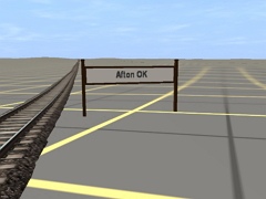
The'Afton Sub'is a terrain generated map of the St Louis & San Franscisco RR (Frisco) from Ft Scott KS to Afton OK .The route is approx.89 miles long. The map has 1607 baseboards, and covers 322 sq miles. There are no 'Tiger Lines' shown, but small signs, indicating the location of cities and towns, have been placed along the track so that conditions in those areas, (Multiple track, yards, roads ,waterways, etc.), can be accessed using USGS topo maps.
- Afton Sub
- afton sub.jpg 30.80KB
- config.txt 3.04KB
- mapfile.bmk 330 bytes
- mapfile.gnd 76.02MB
- mapfile.lyr 23 bytes
- mapfile.obs 1.10KB
- mapfile.trc 32 bytes
- mapfile.trk 42.74KB
User photos
No one has uploaded a photo of this object yet.
1
Comments:
Sign in to post a comment